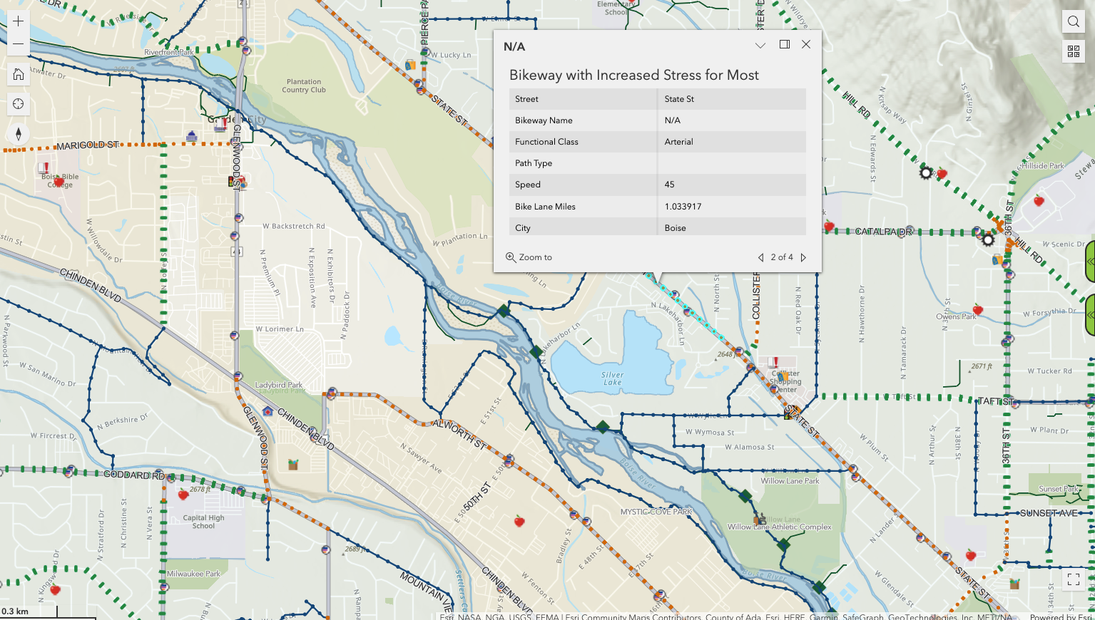
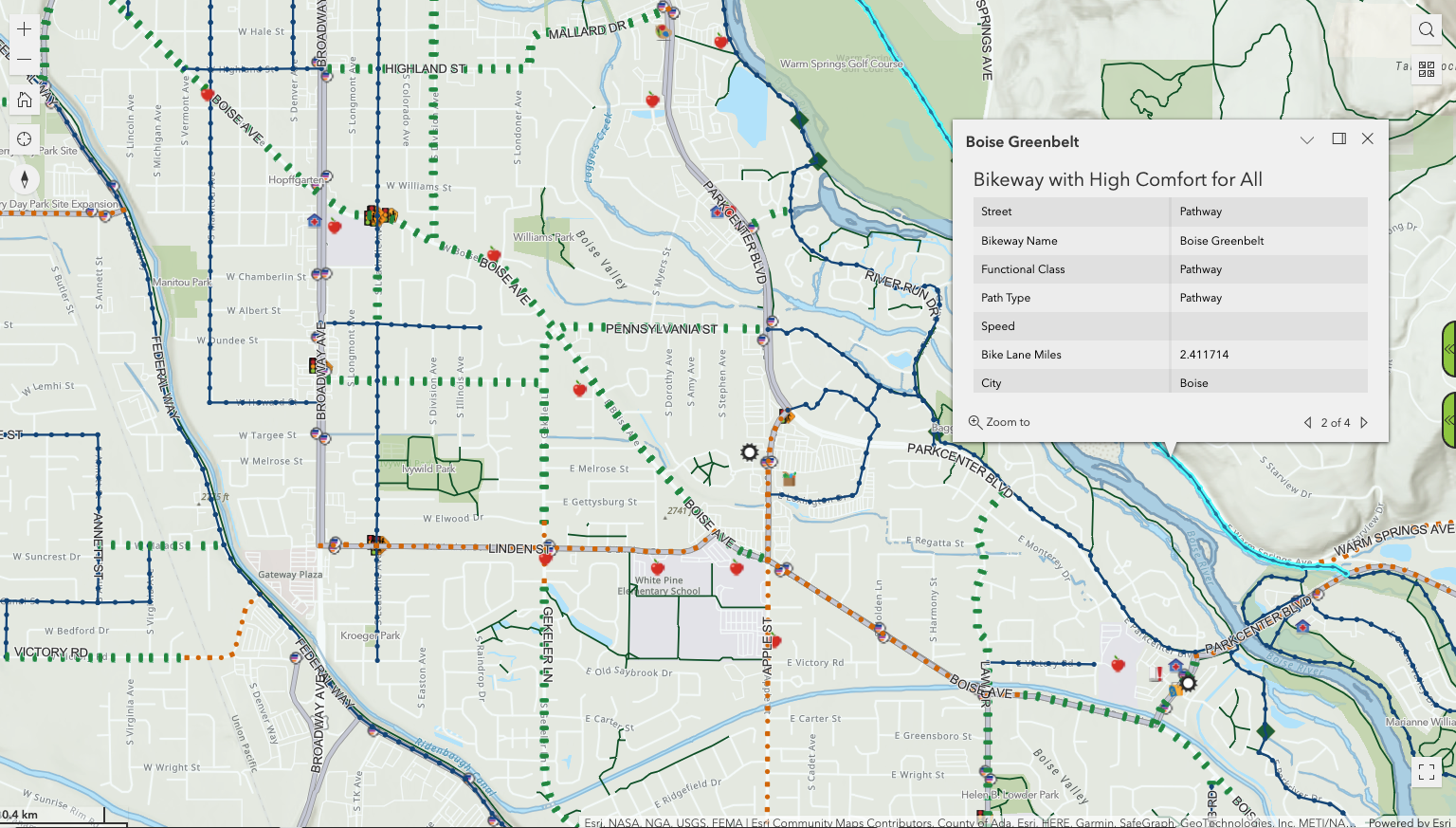
The Ada County Highway District has released an online and mobile version of their bike map, displaying routes across Ada County. Routes are color-coded for difficulty: Bblue means “bikeway with high comfort for all,” green is comfortable for adults, and orange indicates “increased stress,” which are typically along busier roadways.
On the right side, one of the tabs allows you to create a route, giving you a distance and time like on other apps. As of yet, it doesn’t include expected biking times.
(ACHD)
This map has a lot of other information, though. It has bike repair shops, schools, parks, libraries, relevant signages, and Valley Regional Transit routes, and can be updated with traffic or accident information as needed.
Essentially, this does a lot of things that Apple or Google Maps does, except it gives more specific route information and resources for commuting and traveling all in one place.