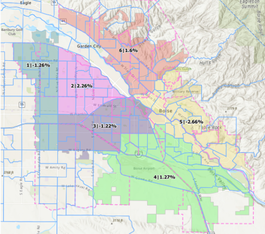
Boise’s city council unanimously approved the city’s first commission-drawn council map last week.
In 2020, the Idaho Legislature began requiring cities with over 100,000 residents to elect city council members by district. Previously, city council seats were elected city-wide, and were disproportionately held by wealthy North and East End residents.
The map drawing was a long and arduous process, with twenty different iterations being considered over the three-month process, all aimed at keeping populations between districts as equal as possible.
Here are a few key takeaways:
- The map does not divide any Ada County precincts — of which there are dozens — into different districts.
- However, it does split eleven of the city’s 34 neighborhood associations.
- And West Boiseans aren’t happy, saying that their suburban district should not extend south beyond I-84.
- Perhaps most importantly, five of the six current council members will face a fellow member if they choose to run again.
- That also means that districts two, three, and four will need brand new candidates to represent them on the city council.