
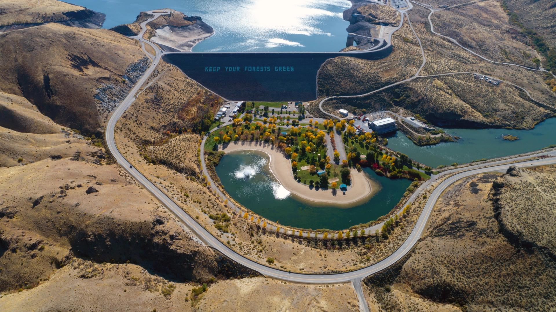
For tens of thousands of visitors and locals, Lucky Peak is the pond in Boise’s backyard. The dam, reservoir, and parks provide the closest boating, fishing, and camping recreation opportunities by far — but why is it called “lucky,” and how did it get there?
The Boise River Valley’s Formation
To understand why the Boise River was dammed at Lucky Peak, it helps to rewind several million years to the time of Lake Idaho: an ancient, massive, and long-lived lake that spanned over 200 miles from Ontario, Oregon, to Castleford, Idaho.
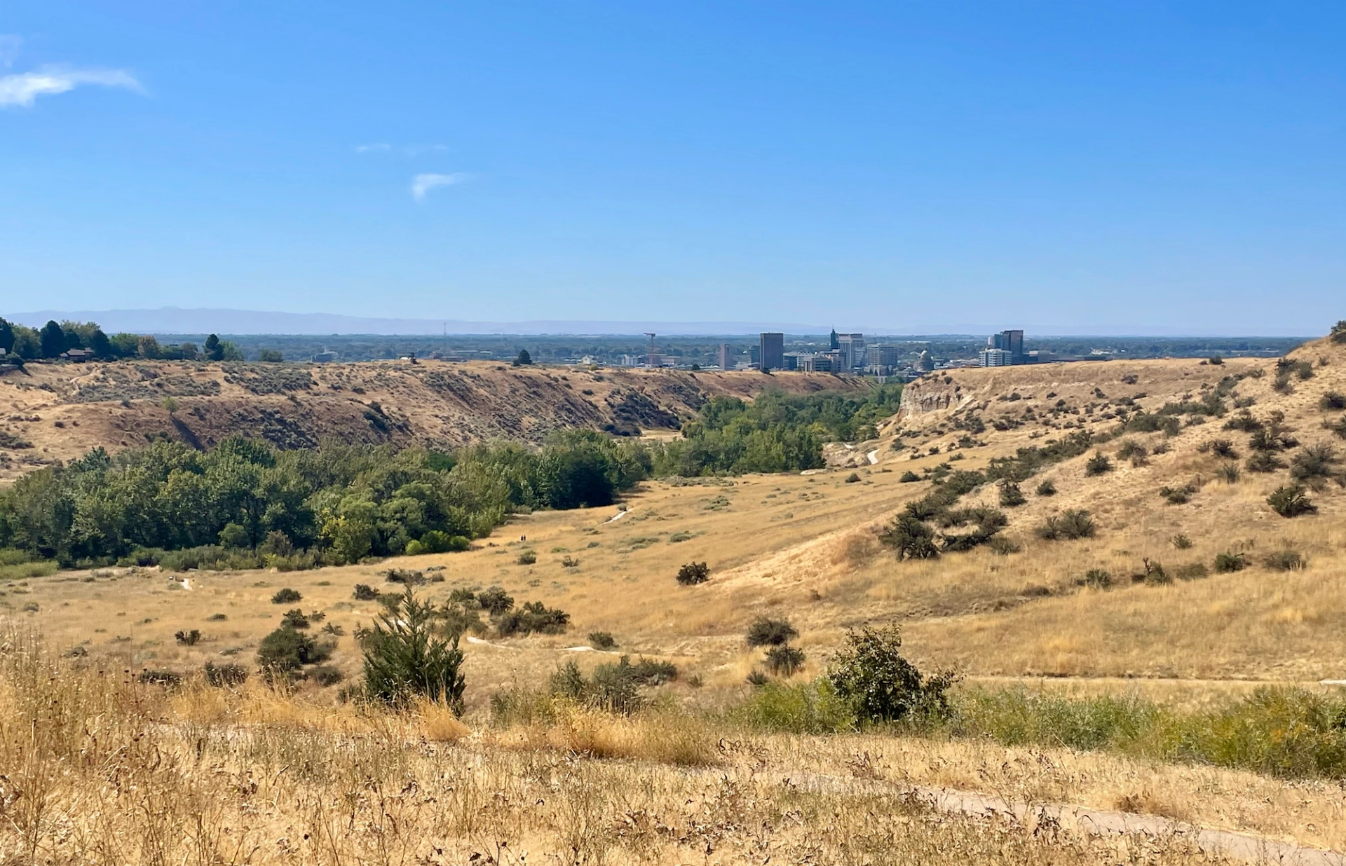
The Boise front (ancestors to today’s Foothills) formed part of Lake Idaho’s shoreline, and the sandy sediment of the shore compacted and formed much of the sandstone found in the Treasure Valley today. When Lake Idaho — and later Lake Bonneville — finally drained, the Boise River began running through the former lakebed that would become the Treasure Valley.
In floods and steady erosion periods called “downcutting,” the river created a series of benches that eventually made up Boise’s own small valley. And those “benches” became a major part of Boise life as the city was settled.
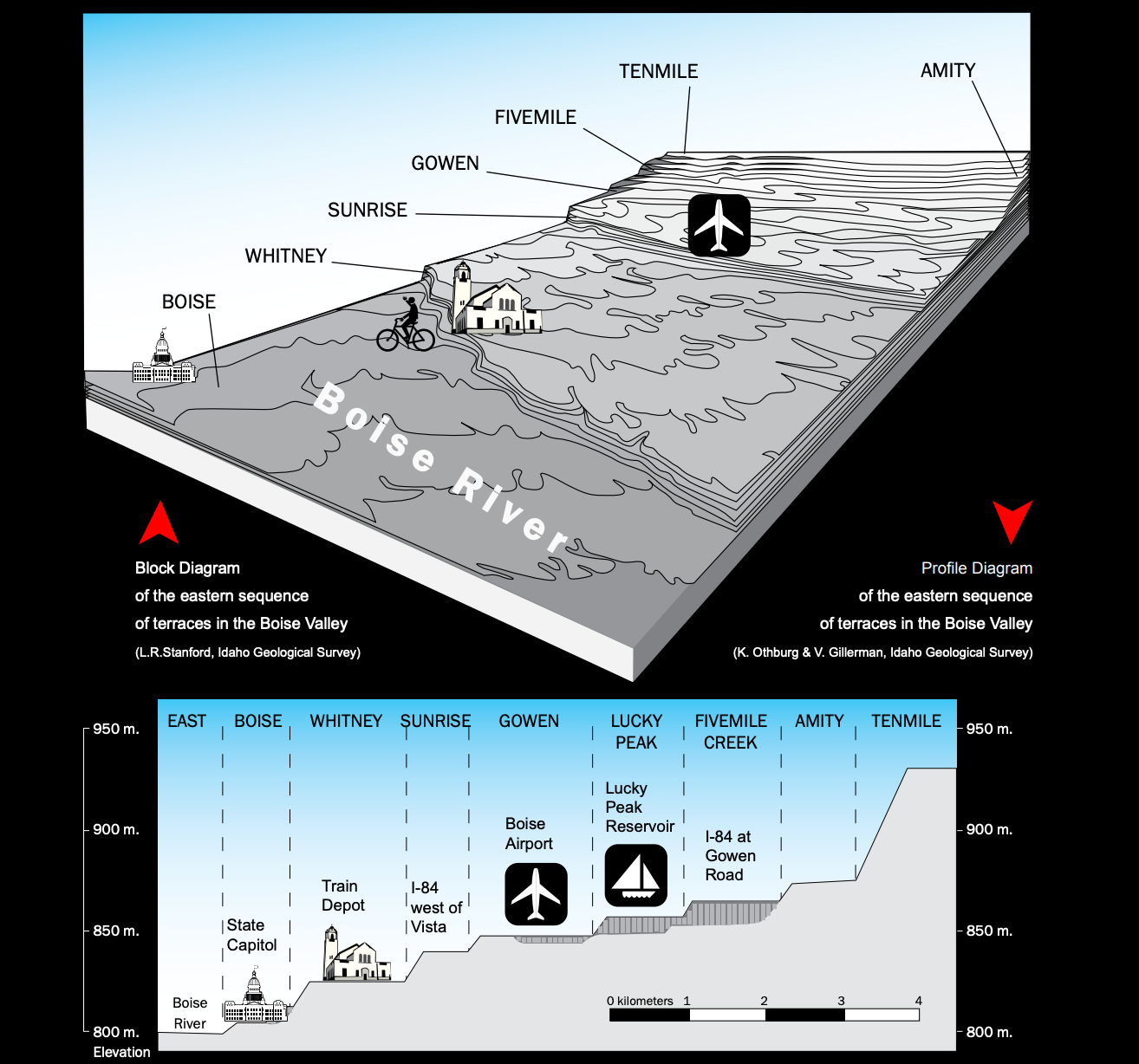
This diagram shows the progressive series of cuts by the Boise River, which produced Boise’s benches. (Bureau of Land Management)
Why Is It “Lucky”?
In 1865, early European settlers began recording floods in the valley, which had the potential to bring hardship each spring especially if crops were destroyed en masse.
Those settlers also found gold and other ores in the Foothills, including in the range’s southernmost peak, Shaw Mountain, which quickly earned the nickname Lucky Peak for its riches. Thus the stage was set for the reservoir and dam, 90 years later.
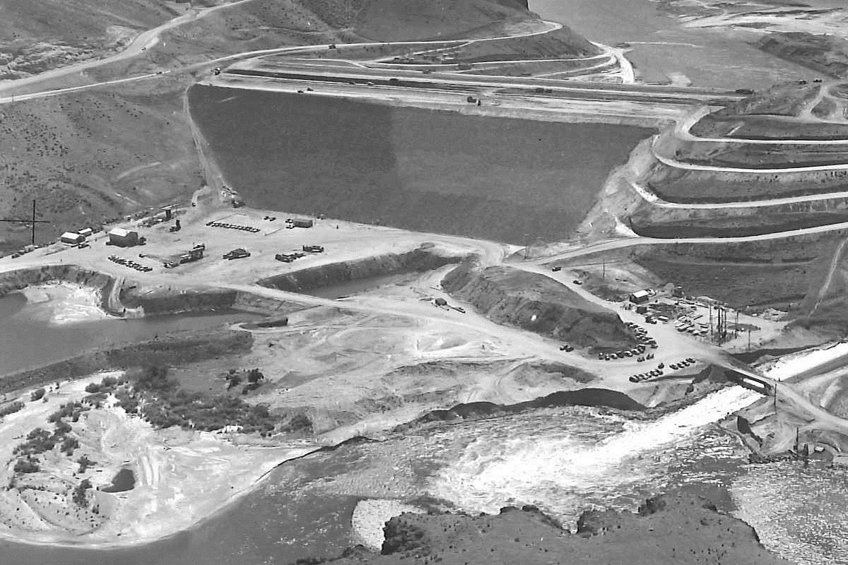
The Lucky Peak Dam and Reservoir were preceded by the construction of Arrowrock Dam further upstream in 1915. Arrowrock crucially created the first flood control of the Boise River, which allowed further agricultural development in the valley.
Before 1988, Lucky Peak was without a hydroelectric station and was only used for irrigation and drainage control. (Hannah Mitchell / US Army Corps of Engineers Walla Walla District)
It wasn’t until 40 years later that, in a spree of dam-building that stored water for irrigation, flood control, and hydroelectricity across America (and employed millions of citizens who needed work during and after the Great Depression), the U.S. Army Corps of Engineers began building the Lucky Peak Dam. In the 1980s, a hydroelectric power station was added to the dam.
Using 1865 as the official incorporation date of the City of Boise, the city has existed for 20 years longer without Lucky Peak Dam than it has with it. As hard as it is to imagine our city without the reservoir, it — like almost everything human-made in the valley — is still remarkably young.
More reading: For example, deer and elk herds which adjusted to the sudden presence of a dam and lake, now have to contend with dangerous roadways and development around it. [Hey Boise]


